The Queen’s Curtain in Sumaguing Cave is one of the tourist destinations in Sagada.
Cordillera has many beautiful places to visit like Sagada and Banaue. But the saying goes “it’s not about the destination. It’s about the journey.”
So while we will surely enjoy our visits to these beautiful spots, we sometimes forget about the sceneries we pass along the road. If we are on a bus, we may even opt to sleep on the way.
The Cordillera Mountains as seen along Halsema Highway.
This is a challenging highway with sharp curves and steep inclines, and declines. But passing here, you will be rewarded with scenic picturesque views along the way.
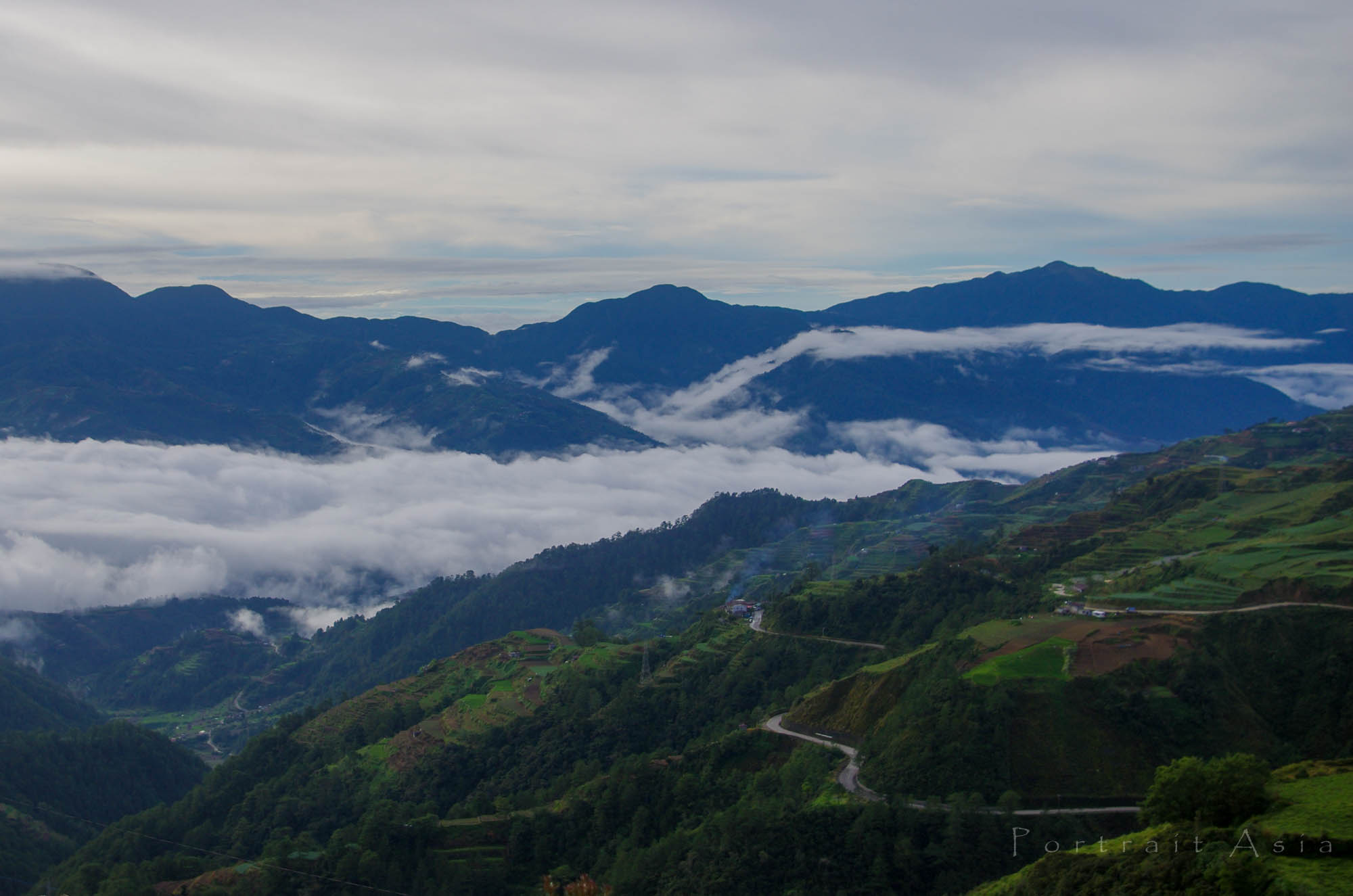
The vegetable terraces of Buguias.
It’s an adventure from La Trinidad, Benguet to Bontoc, Mountain, Province. It also connects to Sagada and to the rice terraces of Ifugao via Bontoc. Benguet offers views of terraced vegetable and flower gardens. The mountain ranges of Kibungan that can be seen after about 30 kilometers of travel (km. 38) are dubbed by some visitors as the Switzerland of the Philippines because of the mountain formation and freezing temperature. What we don’t have here, however, are snows.
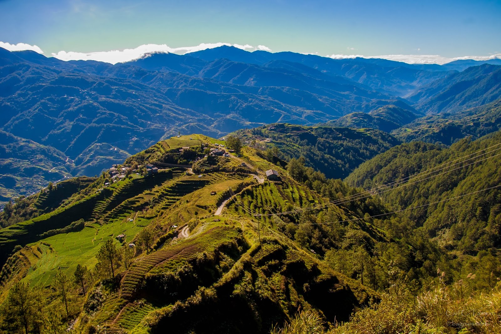
Majestic Mount Pulag in the Background as seen in Atok.
Mount Pulag, the second-highest mountain in the country can be viewed in Atok. Atok was once the highest point of the Philippine Highway system situated at 2,300 meters above sea level (MASL) (7,000 feet).
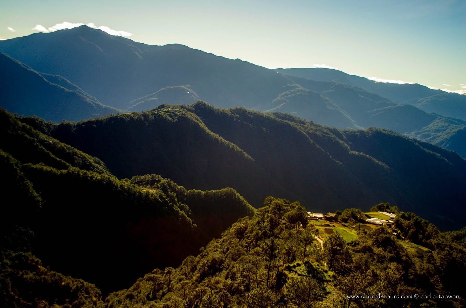
Mt. Usdong overlooking miles and miles of vegetable terraces. The distant mountain on the left is Mt. Pulag while the peak on the right is Mt. Timbac
If you are feeling adventurous, you can take a short detour to Mt. Timbac where you can see a burial cave of some of Kabayan’s mummies. Another short detour you can do is to Mount Usdong in barangay Madaymen, Kibungan where you will see some of the best views of beautiful vegetable terraces. Mount Usdong is 2617 meters above sea level; there you can see the view of Atok, Kabayan, Kibungan, and Buguias.
The first municipality of Mountain Province in Sinto also offers vegetable terraces but as you go deeper into the province, you will see it transforms into rice terraces.
Not only is the road scenic but historic as well. This road is an engineering feat with continuously eroding mountains and solid rock formations. The half tunnel in Atok was carved from a steep ravine of solid rock. This mountain highway formerly known as the Mountain Trail was named after Eusebius J. Halsema in 1953 under Republic Act 933. Halsema was an American Engineer who became the Mayor of Baguio from 1921 to 1937. It was originally a horse trail called the Mountain Trail used by gold prospectors and traders during the Spanish and American regimes. Some of the remains of the old trail not converted into a road are still called Spanish Trail.
When Halsema became the Mayor for Baguio, he fought for the improvement of the road. The national government complained of the enormous amount needed to finish the road but Halsema insisted that it will bring progress to the region and eventually to the country, making use of the mining industries in the nearby towns as one of the reasons. In fact, one of the reasons Baguio was created was because of the surrounding mines in the region. Baguio’s logo has four four gold coins representing the old mines in Benguet.
To augment the needed labor, the local citizens were utilized. Having no money to pay for their taxes as the medium of exchange back then was usually through the barter system, they contributed days of labor per year in the road construction. Some of them complained about this forced labor and they called Halsema “busol” or “buso”, a mean person who takes advantage of others. Halsema’s methods may be mean but without that resolve, this road may not have been built during his time, or perhaps not at all.
Road construction started in La Trinidad and Bontoc. This writer’s grandmother tells of how they would put the workers on suspended barrels and lowered them over the mountainsides to dig holes for dynamites using hammer and chisel.
Eventually, the road construction slowly crawled but it did crawl. And in 1933, after eleven years of hard labor, the first car arrived for the first time in Bontoc.
When you pass by Guioeng to Balangabang (km. 40 to 48) or in Sabangan in Mountain Province, try to imagine how hard it was to build this highway back then with no heavy equipment. Next time you pass by this road, you may want to reflect on the blood, sweat, tears, and even people’s lives that were sacrificed during its creation and have a better appreciation of this mountain highway.
 The Lingling-o: History, Interpretation, and the Search for Evidence
  The Kankana-ey Calendar: A Timeless Symphony of Nature and Culture
  Igorots: The so-called savages of the Cordilleras
  Od-odio, the Narra Tree Song
  Baguio Creatives finding ways to rise above Pandemic
  Baguio City Creative Christmas Trees
  How a wooden spoon started a creative village
  The Sagada Way
 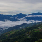 The Mountain Trail Thrill